
Some
of Our
Favorite
Roads in Colorado
Some
of Our
Favorite
Roads in Colorado
It
is hard to narrow down this list, but here are some of our favorite motorcycling
roads out in the mountains. Each of them either crosses
a
high mountain pass or follows along a scenic river/canyon !
Individual
Rides:
#1 CO-14 Fort Collins to Walden (Poudre
River, Cameron Pass)
#2 CO-125 Granby to Rand (Willow Creek, Willow Creek Pass)
#3 US- 40 Winter Park to Empire (Berthoud Pass)
#4 CO-133 Paonia to Carbondale (McClure Pass - Crystal River)
#5
CO-92 Gunnison to Hotchkiss (North Rim of The Black Canyon
of the Gunnison)
#6 US-50 Sargents to Poncha Springs (Monarch Pass)
#7
WY-70 Slater, Co. to Encampment, Wy. (Battle Pass)
Favorite motorcycling roads along the Front Range:
#1 CO-74, CO-103, Morrison, Evergreen, Bergen Park, Squaw Pass, Echo Lake
#2 CO-67, Woodland Park to Deckers; JeffCo-126, Deckers to Pine Junction
#3 Deer Creek and South Turkey Creek Canyon Roads (from SW Denver)
#4 Boulder and Left Hand Canyon Roads (from Boulder)
#5
CO-105, Sedalia to Palmer Lake
Some other favorite roads for their scenery:
#1 US-550, Durango to Ouray (Millon Dollar Highway, Molas Pass)
#2 CO-82, Twin Lakes to Aspen (Independence Pass)
#3 US-24, Minturn to Leadville (Tennessee Pass)
#4 US-34, Granby to Estes Park (Rocky Mountain National Park)
#5
CO-149, Gunnison to South Fork (Lake Creek, Slumgullion Pass,
Rio Grande River)
Ok, it isn't in Colorado, but it starts and ends here, and is a worthwhile trip.
Medicine Bow Mountains southwest of Laramie, WY.
Starts and ends in Ft. Collins. Explore highways 230, 130,
and 70; Snowy Range and Battle Passes. Overnight in the
Encampment / Saratoga area. Call for information about
reservations. Approx 380 miles. Meet at the Conoco
station just west of the I-25/CO-14 exit at the north edge
of Ft Collins. Early birds can get breakfast at the Dennys
right across the road.
Perry Park, Palmer Lake
Start
in SW Denver just south of C-470 and Wadsworth. We'll take the twisties
down through Deckers to Woodland Park, then loop around to the west through
Lake George, Jefferson and Kenosha Pass.
Deckers
Loop
May
22, 1999
Pine
Junction, Deckers, Woodland Park, Lake George,
Tarryall, Jefferson, Kenosha Pass.
The
ride started with the 130 curves of Deer and Turkey Creek Canyons on our
way
to Aspen Park. A few miles to the west we turned off US-285 at Pine
Junction
and headed south through the tight turns along the North Fork of the
South
Platte River through Pine and Buffalo Creek. Then it was a bunch of
higher
speed sweepers across the hills to Deckers. A quick stop for water, etc.,
then
on through the forests to Woodland Park for a lunch stop.
Colorado
at its most spectacular. The roads were occasionally damp from recent showers.
Berthoud Pass was a treat this early on a Sunday morning with no traffic
- especially the north side, which has abundant tight and sweeping turns.
Kremmling to the base of Rabbit Ears Pass is also an excellent stretch
of sweeping turns. The park in Maybell offered a snack stop opportunity.
This park is a good fee camping spot with lush grass for tents and restrooms
with a shower.
Summer Solstice Tour
The
St.Vrain river full of rushing water and the winding road through the canyon.
Peak to Peak Highway. Swapping howdies with another motorcycle group at
Estes Park. Rocky Mountain National Park. Trail Ridge Road. Elk with big
antlers. Tourist traffic and a pace that let us take in all the scenery.
Snow banks along the road. Dark skies ahead. A short break at 11,796'.
Milner Pass. Beautiful
views
at Fairview Curve. Light rain through the forest. Soft, pretty light on
the
headwaters
of the Colorado River.
Lunch
with happy Concours riders at Grand Lake. Sail boats on Shadow
Mountain
Lake. Dark skies toward the north. Riding the empty, curvey road
along
the creek up toward the Divide. Cooler temperatures and more light rain
approaching
Willow Creek Pass. A couple photos in the drizzle. Back down the
empty,
curvey road. A stop in Granby for gas and for telling each other what a
fun
road we just traveled. Zooming up to Berthoud Pass. Another photo and
good-byes
before heading back to town.
Medicine
Bow Mountains southwest of Laramie, WY.
WY-230 and Battle Pass.
Colorado to Medicine Bow Range, Wyoming
Our
July ride, with seven bikes and eight folks, took us up on the Colorado
-
Wyoming
border to explore some roads many of us had never seen. The
highlight
was WY-70 between Encampment and the Colorado border.
Pete,
Carey, Lance, and I joined up in SW Denver for the ride to Ft Collins
where
we were met by Doug, Kathy, Rick, and Carl. We headed north on
US-287
over the forested hills that turned to high plains just across the
Wyoming
border. A stop for gas at Laramie, then west on WY-130 across the
plains,
with views of the Medicine Bow Range in the distance. At Centennial the
road
started to twist and climb into the scenic mountains. The guys in the lead
stopped
at Snowy Range Pass (el 10,947') so we could enjoy the great
mountain
vistas to the east and west and the snow covered mountains rising just
north
of the Pass. Some of us got a "guided tour" of a Kawasaki Vulcan 1500
Drifter
that was stopped there too.
We
continued on west, winding down out of the mountains to the North Platte
River
valley and to the town of Saratoga for lunch. Pete said there was a good
"ma
and pa" cafe in Saratoga, so the lead guys stopped at "Ma's Cafe". I had
a
hamburger,
Carl had soup... Nevermind, Doug said this shouldn't be a food
review.
Anyway, we decided WY-130 to the north probably wouldn't be all
that
scenic so we went straight on down WY-230 to Riverside where we had
spaces
reserved at Lazy Acres Campground. Nice cool place right by the
Encampment
River with lots of shade trees. Larry and Judy, the owners, treated
us
like guests at their house rather than just as paying customers. Great
Wyoming
hospitality.
After
the tents were set up, and two cabins moved into, we headed west to
explore
WY-70. The maps showed it to be paved for a ways then to turn to
gravel,
so we figured we would ride it as far as it was good and/or fun. We
enjoyed
the sweeping corners and great pavement up to Battle Pass (el 9,915'
on
the Continental Divide) where we stopped to view the scenery. We were
surprised
to see the road still paved to the west so we took off again. After miles
of
more sweepers we paused at a scenic turnout where we could see Hahns
Peak
and the other mountains near Steamboat Springs, about 25 miles to the
south.
On west again, finally stopping at Slater, Colorado (one house and an old
mobile
home that is the post office). We couldn't believe almost perfect road
conditions
(the road isn't plowed in the winter so it doesn't suffer freeze / thaw
problems),
the lack of traffic, sweepers one after another, and the beautiful
mountain
scenery. So we turned around and did the 45 miles right back to
Encampment!
After
settling back into camp, we walked across the highway to the Bear Trap
Cafe
for supper where we ate good food (vs. Dintymore Beef Stew) and talked
about
the day. Then back to the campground for stories around the fire.
Powdered
sugur donuts, or Bear Trap, for breakfast, then time to hit the road.
Lance
headed for Walden and a return down the Poudre River canyon. Pete
went
through Walden on his way to Willow Creek and Berthoud Passes. Doug
and
Kathy went back over Snowy Range Pass on their way to check places in
Cheyenne.
The rest of us went down WY-230 which runs through a large valley
full
of ranches bordered by hills to the east and mountains to the west. Near
Cowdrey
we went back north on CO-127 and WY-230 through the Medicine
Bow
National Forest. A pretty ride with winding canyons on either end and a
plateau
of forests in the middle. At Laramie we went south on US-287 and did a
little
exploring of the Red Feathers Lakes area. From there we took a neat 10
mile
gravel road that put us down in the Poudre River canyon where we had
plenty
of time to enjoy the scenery while stuck behind Sunday afternoon traffic.
In
summary, it was a terrific two-day riding / camping event highlighted by
the
45
miles of WY-70 and the campground at Riverside. Requests are already in
for
a variation of this trip next summer.
-- Randy Bishop, Littleton, Colorado
Black
Forest, Garden of the Gods, Palmer Lake, Perry
Park
There
has been a lot of snow in Colorado since mid-March, but for our first COG
ride of 1998 we had sunny skies and 75 degrees. Nine of us, on eight Concours
and
one Vulcan, met at the south edge of Denver for an easy ride on a pretty
spring day. We went down US-8 through the Black Forest area, enjoying the
views of Pikes Peak in the distance. In Colorado Springs we cut through
Garden of the Gods and stopped a Balanced Rock for a group photo and some
motorcycle chatter. Carl and Valarie on another Concours joined us at lunch
time for sandwiches and more good motorcycling conversation. Afterwards
we headed north on I-25 for Monument and then west to Palmer Lake for a
scenic ride on CO-105 up through the Perry Park area along the edge of
the foothills. A very nice spring ride.
Route of the Ride the Divide
Day 1:
US-160, Pagosa Springs to Wolf Creek Pass (10,850), South
Fork.
CO-149 to Creede, Spring Creek Pass(10,901), Slumgullion
Pass (11,361), Lake City, US-50.
US-50 to Gunnison, CO-114.
CO-114 to North Cochetopa Pass (10,149), Saguache.
US-285 to Mineral Hot Springs, Poncha Pass (9,010), Poncha
Springs.
Day 2:
US-50, Poncha Springs to Monarch Pass (11,312), Gunnison,
CO-92.
CO-92 to Hotchkiss.
CO-133 to Paonia, McClure Pass (8,755), Carbondale.
CO-82 to Aspen, Independence Pass (12,095), Twin Lakes,
US-24.
US-24 to Leadville, Tennessee Pass (10,424), Minturn.
Day 3:
I-70, Minturn to Vail Pass (10,603), Copper Mountain.
CO-91 to Fremont Pass (11,320), Leadville.
US-24 to Buena Vista, Johnson Village, Trout Creek Pass
(9,346), Antero Junction.
US-285 to Fairplay.
CO-9 to Hoosier Pass (11,541), Breckenridge, Swan Mtn Road
(at south edge of Lake Dillon).
Swan Mtn Road around south side of Lake Dillon to US-6.
US-6 to Keystone, Loveland Pass (11,992), I-70.
I-70 to Georgetown, US-40.
US-40 to Empire, Berthoud Pass (11,307), Winter Park,
Granby.
US-34 to Grand Lake, Rocky Mountain National Park, Milner
Pass (10,759), Estes Park.
Day 4:
US-34, Estes Park to US-287 (or turn off to Masonville).
US-287 (or Masonville Road) to CO-14.
CO-14 to Cameron Pass (10,276), Walden.
CO-125 to Rand, Willow Creek Pass (9,683), US-40.
US-40 to Hot Sulphur Springs, Kremmling, Muddy Pass
(8,772), Rabbit Ears Pass (9,426'), Steamboat Springs.
Two
other passes over the Divide that weren't part of RtD but are
worth
the ride up and back down are Cottonwood and Boreas. The
paved
road to Cottonwood Pass (12,126) heads west from the traffic
light
in Buena Vista to a great view down into the Taylor Park area.
The
very scenic gravel road to Boreas Pass (11,482), easily traveled
on
a motorcycle, starts at the south edge of Breckenridge across from
the
Conoco station and follows an old rail bed up to the former
townsite
of Boreas.
1000 Mile Ride Around Colorado
Here
is a good 1000+ mile route around Colorado that was reported
in
the Concourier, Volume 8, Issue 2. The route includes mountain
scenery
in four crossings of the Continental Divide and many miles
of
two lane roads. It concludes with some easy Interstate riding.
Start in Littleton.
I-25 to Fort Collins.
CO-14 to Cameron Pass (10,276'), Walden.
CO-125 to Willow Creek Pass (9,683), US-40.
US-40 to Kremmling, Muddy Pass (8,722), Rabbit Ears Pass
(9,426), Steamboat Springs, Craig, Dinosaur.
CO-64 to Rangely.
CO-139 to Douglas Pass (8,268), Loma, I-70.
I-70 to Grand Junction.
US-50 to Delta, Montrose, Gunnison, Monarch Pass (11,312),
Poncha Springs.
US-285 to Poncha Pass (9,010), Mineral Hot Springs.
CO-17 to Alamosa.
US-160 to North La Veta Pass (9,413), Walsenburg.
I-25 to Littleton.
To
use this route to qualify for an Iron Butt Association SaddleSore
1000
award, check the IBA's documentation rules at
www.ironbutt.com.
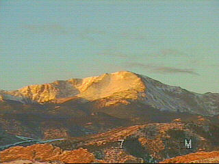
At the summit of Pikes Peak, Katharin Lee Bates was inspired to pen the lines to her most famous poem, "America the Beautiful." She was overwhelmed by the sights of vast, open skies, planted fields, and the majestic Rocky Mountains.
http://www.pikespeakcam.com/images/peakcam.avi
http://www.micapeak.com/WetLeather/pages/camping.html
http://www.concours.org/long.distance.tips.html
http://www.ironbutt.com/